New - 11 Hours Ago










Zip Code Pages: 80106 | 80108 | 80118 | 80132 | 80133 | 80808 | 80809 | 80813 | 80814 | 80816 | 80829 | 80827 | 80831 | 80863 | 80903 | 80904 | 80905 | 80906 | 80907 | 80908 | 80909 | 80910 | 80911 | 80915 | 80916 | 80917 | 80918 | 80919 | 80920 | 80921 | 80922 | 80923 | 80924 | 80925 | 80926 | 80927 | 80928 | 80951
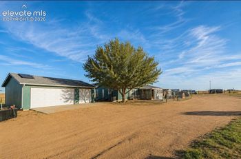
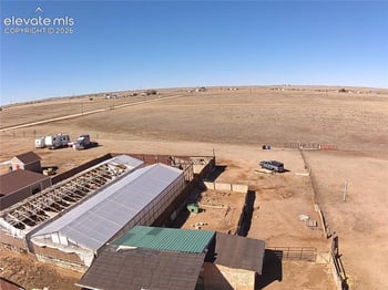
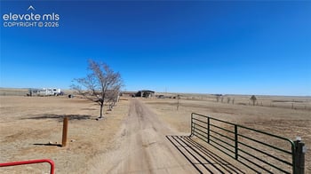
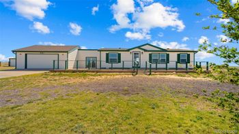
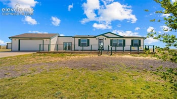
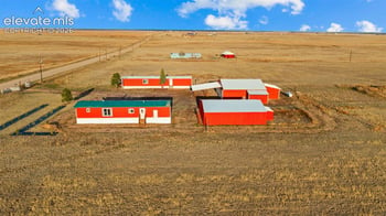
Zip Code 80864 is the postal address for Yoder, an unincorporated community on the high eastern plains of El Paso County, about 33 road miles east of Colorado Springs along Highway 94. There is no town center, no municipal water, and no retail inside the ZIP. What the area has is open land: short-grass prairie under wide skies, Pikes Peak visible on the horizon to the west, and agricultural parcels ranging from 35 acres to several hundred. Most of what sells here is either raw land or a home sitting on large acreage, and the search works differently than any ZIP closer to the city.
The ZIP also includes the Edison and Truckton community aliases in listing databases, so searches for any of the three names return the same inventory. The clickable zip code map on this page lets you compare 80864 with neighboring 80928 and 80831 without starting a new search.
Most of the questions that shape a purchase decision here cannot be answered from a listing sheet. The water source, the school district assignment, the road access, and the zoning rules each need their own look before a parcel visit turns into a serious conversation.
There is no municipal water service in Zip Code 80864. Every property relies on a private well, a cistern with hauled water, or some combination of the two. The distinction matters more than buyers from the city often expect. A productive well with good flow rate and depth documentation is a different asset than a cistern that depends on water delivery schedules and storage capacity. On raw land parcels, the seller may have no water infrastructure at all. Buyers need to understand what a well permit application involves, what drilling costs look like in this part of El Paso County, and whether the parcel's zoning allows a cistern as a permanent water solution while a well is being developed.
We walk buyers through the well permit and water source conversation on every acreage showing east of the city. The acreage living guide on Great Colorado Homes covers what rural water systems actually look like day to day, helping buyers calibrate expectations before the first tour.
Most of the 80864 ZIP falls within Edison School District 54JT, one of the smallest rural districts in Colorado, serving roughly 190 students K-12 on a single campus at 14550 Edison Road. Some parcels in the southern and eastern portions of the ZIP fall under Miami/Yoder School District 60JT instead. The district assignment is not obvious from an address alone. Confirm which district covers any specific parcel before building school plans around a purchase, since both districts operate at a scale and structure that differs considerably from the larger districts closer to Colorado Springs.
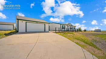
The dominant zoning in 80864 is A-35, which requires a minimum 35-acre parcel and allows agricultural uses, including livestock, horses, and accessory structures. Many parcels explicitly permit manufactured and modular homes, which is a meaningful difference from most suburban zoning around Colorado Springs. Most land carries no HOA and no covenants, so buyers have more flexibility about what they build and how they use the property.
Road access deserves its own look by parcel. Some properties front county-maintained paved roads. Others access the parcel through ingress/egress easements across neighboring land, with no maintenance obligation on the county. Ask for the access documentation and check whether the road is graded and passable year-round before a winter showing turns into a longer conversation.
A few other items to check before any offer:
The inventory here does not follow a typical suburban price-per-square-foot pattern. Lot size, water infrastructure, and existing improvements carry more weight than finish level:
The acreage homes search on Great Colorado Homes pulls properties from this ZIP and the surrounding rural corridor if you want to compare lot sizes and price ranges side by side.
Highway 94 is the primary road in and out. Schriever Space Force Base is the closest major employer, roughly 20 minutes west on Hwy 94, making 80864 a known choice for military families who want acreage and can handle the commute. Peterson Space Force Base and the Powers corridor add another 10 to 15 minutes beyond Schriever. Downtown Colorado Springs is 45 minutes on a clear day.
Daily errands require planning. The nearest grocery and fuel options are in Ellicott, roughly 10 minutes away, or Falcon, which is closer to 30 minutes depending on where in the ZIP the property sits. Buyers who have lived in suburban Colorado Springs sometimes underestimate how much the logistics change when a routine grocery run becomes a 25-mile round-trip.
Zip Code 80864 rewards buyers who sort out the water, the district, and the road before they fall for the views. Pikes Peak anchors the horizon to the west, no neighbors are visible from the property line, and the skies do not look like anything inside the city limits. But each of those variables is address-specific, and a 35-acre parcel on one road can answer them differently than a parcel one section over.
If you are moving to Colorado from out of state and the acreage search is part of the plan, the eastern El Paso County corridor from 80928 through 80864 is worth understanding as a range, not just a single ZIP. For military buyers commuting to Schriever or Peterson, the PCS guide for Colorado Springs covers the east corridor and what buyers in that commute position typically weigh.
Call 719-357-7366 to talk through the 80864 search. I can help you understand what water documentation to request before touring a parcel, how to compare raw land versus an existing homestead at similar prices, and how this ZIP fits into the broader acreage search east of the city.